“And this, our life, exempt from public haunt, finds tongues in trees, books in the running brooks, sermons in stones and good in everything”… William Shakespeare.
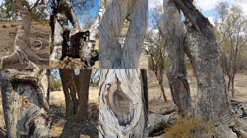
It is not hard to find tongues in trees out here as there are so many old scartrees still standing. This land west of Walgett is unique in its lack of development, bushfires, and surface water. We have a perfect storm of historical, climatic & geographical circumstances so interpretation is hampered only by a lack of interest. There is so much to learn from the creation and maintenance of Ringtrees and Twisters and other CMTs that make up the mysterious language of the trees. I think there are actually two message systems communicated by various scars, firestick brands & structural manipulations. There is the local information regarding the location of camp sites and clan whereabouts etc as well as a range of symbols that were universally understood like rings in the tree trunks.
Last week I found a very old Bimblebox Ringtree and nearby an aged Bambul ( Capparis mitchellii ) Ring with a tripod base. How the hell they got these trees to collaborate with all this manipulation I don’t know as neither box or bumble fuse naturally. Coolabah & leopardwood are more cooperative but still need generational maintenance. What skills we have lost since colonization…. tree ringing, twisting, plaiting, pairing and transplanting as well as the ancient burning practices ensuring sustainability. How many National parks have to burn down along with all the neighboring farms and towns until we relearn how to manage the land? The template is still here and you can even see where the people placed their fire sticks briefly while they did something else. We need more than token consultation we need a total re-education of politicians, bureaucrats & park rangers.
As well as those new Ringtrees on a neighboring property I refound one I had lost temporarily – don’t laugh…not yet totally demented – but you try keeping all these vital CMTs spread over 100,000 acres or so in your head. This long dead Coolabah (with the side coolamon in collage) lines up with the Coolabah Ring + pointer about a km west & the impossible Leopardwood branch Ring at the natural water hole 2 km before that. “Natural” being a relative term as more information comes to light on Aboriginal engineering & channel making. Once we plot & orientate these trees with our “natural” water sources (limited) and large campsites & artefact areas (many) we may find some answers. This mapping will include other known gathering spots like the Narran Lakes, Barwon river & Brewarrina fishtraps to give us the bigger picture.
Hopefully soon we will be able to move on from individual CMTs to find the “complete story” that may have functioned over all the eastern seaboard of Australia. Jacqueline Power, a lecturer from UTAS, wrote for The conversation 25/06/2018 re the ring trees in Watti Watti country in NthWest Victoria,
‘There is one ring tree that is recognised by the broader community and even sign-posted. It is located in the township of Koraleigh on the New South Wales side of the state boundary. Its context has been disrupted by colonisation, cut-off from the broader environmental and cultural landscape, and is flanked by a road and a paddock. Due to the disruption of its context, this tree has become a single “site”, rather than part of the wider cultural landscape – isolated and dislocated from its complete story. It is now a stranger in an agrarian landscape. The tree is no longer alive, impacted by the drought and lack of access to the river, although its heart-shaped ring remains visible.’

